BIMatrix Builds Natural Language Analysis AI Satellite Platform
IT DAILY ·
✦ AI Summary
BIMatrix has completed building an advanced satellite information integrated analysis and data utilization platform based on generative AI.
The achievement was the result of work on the Ministry of Science and ICT and Institute for Information and Communications Technology Planning and Evaluation (IITP)-supported project, "SW Computing Industry Core Technology Development (Computing Core Technology Project)."
Based on this, BIMatrix plans to step up its push into the public disaster response market.
BIMatrix announced on the 29th that it has completed building an advanced satellite information integrated analysis and data utilization platform based on generative AI, and that it plans to ramp up its push into the public disaster response market. The achievement was the result of a project supported by the Ministry of Science and ICT and the Institute for Information and Communications Technology Planning and Evaluation (IITP). The project was titled "SW Computing Industry Core Technology Development (Computing Core Technology Project)."
The achievement came from the successful completion of the project, "Development of a generative AI-based satellite information integrated analysis and supply-utilization platform through metadata learning." The project ran for a total of 1 year and 9 months. BIMatrix was the lead organization.
The project was carried out as a consortium involving BIMatrix, Miso Information Technology, the Korea Aerospace Research Institute (KARI), and the Industry-Academic Cooperation Foundation of Chosun University. After the project was completed, the consortium conducted ground and orbital verification using a small satellite, four satellites currently in operation, and drones.
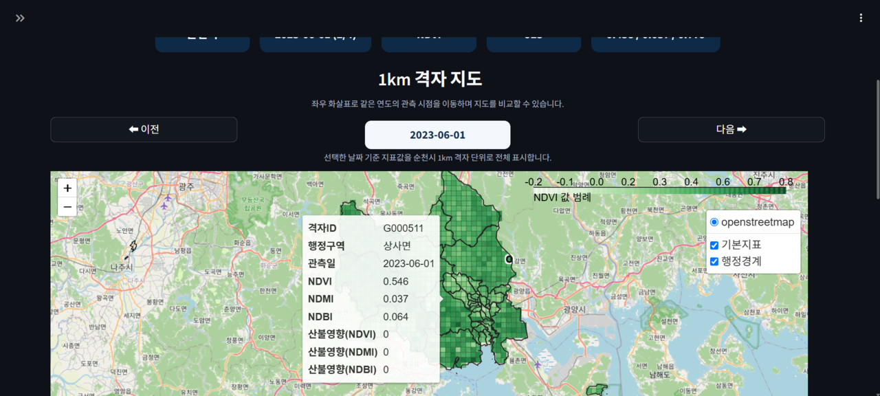
Through such verification, the consortium completed preparations to move into full-scale service. Accordingly, BIMatrix will begin in earnest its push into the public disaster response market. The article included a photo of a satellite data visualization screen, which was provided by BIMatrix.
The project aims to support access to and use of small satellite and satellite constellation data for small and medium-sized enterprises, universities, and research institutions that have difficulty building their own ground station facilities and expensive dedicated data centers. To that end, it supports the smooth use of collected data.
BIMatrix developed an integrated satellite information analysis and supply-utilization platform. The platform is based on satellite data collection, preprocessing, analysis, and visualization technologies, and it has functions that automatically process data received through ground station links and convert it into an analyzable form. It is also designed to allow automatic satellite data collection, ARD (Analysis Ready Data) generation, data storage and management, geospatial visualization, and sector-specific analysis in a single environment.
The platform also includes a natural language-based query function. This allows users without specialized knowledge of satellites and geospatial information to easily search and analyze information.
As public and private satellite data linkage expands, the areas in which satellite information can be used are likely to broaden to disaster response, environment, agriculture, forestry and fisheries, land and urban management, and critical facility monitoring. Accordingly, the development plan for the satellite information utilization platform has been set around helping specialized satellite information be easily analyzed and used in industry and public sectors. The goal of the platform is a general-purpose satellite information utilization platform.
BIMatrix said it developed the AI platform in cooperation with institutions including the Korea Aerospace Research Institute, noting that this is a time when national aerospace policy is being strengthened and the importance of responding to the climate crisis is growing. It added that, beyond technology development, it plans to advance the platform into a highly complete AI platform that can be deployed immediately in the field, and to develop it into a general-purpose satellite information platform that can be used on site.
BIMatrix said it has research capabilities in its data analysis platform and commercialization track record. It also expressed its commitment to driving innovation in public disaster management and the use of national spatial information. Meanwhile, BIMatrix Trinity obtained Grade 1 certification from GS (Good Software) in July.
Source: IT DAILY · Kwon Young-seok
Original: https://www.itdaily.kr/news/articleView.html?idxno=241880
References
This article was produced with the help of an automated content generation algorithm.
Source: IT DAILY
View originalThis article was summarized and organized by BizCrush based on the original article from IT DAILY. For exact quotations and full details, please refer to the original article.