Google and NASA Use Satellite AI to Automatically Track Methane Emission Sources
AI TIMES ·
✦ AI Summary
According to AI TIMES, Google, together with NASA's Jet Propulsion Laboratory, has unveiled a technology that uses AI to analyze satellite i…
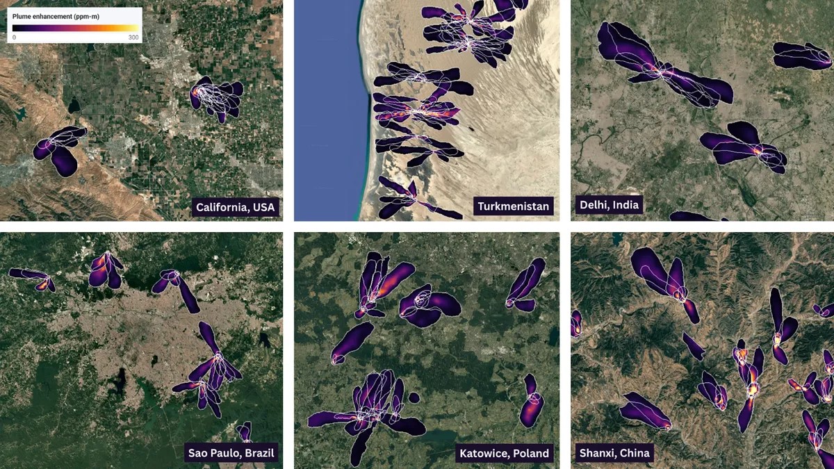
According to AI TIMES, Google, together with NASA's Jet Propulsion Laboratory, has unveiled a technology that uses AI to analyze satellite imagery and automatically identify the locations and spread patterns of methane emission sources. The technology, announced on the 9th, was trained on actual imagery with 3.6 million virtual methane plumes inserted and detected 84% of plumes confirmed by experts. Its key feature is that it does not stop at looking only at methane's spectral signals in hyperspectral satellite data, but also reads the shape of plumes as they spread with the wind and the surrounding terrain to distinguish real emissions from false signals. It is designed to narrow down candidate areas even when emissions are not large or when multiple plumes overlap. The researchers see the results as the foundation for a global monitoring system and have also made the database and model public so that policymakers and industry can use them for on-site inspections. With NASA's next-generation imaging spectrometers expected to further increase the volume of observations, the need for automatic analysis to supplement human interpretation is also coming into sharper focus.
Perspective
The key point in this issue is that climate action is shifting from declarations or estimates to an operational system that pinpoints actual emission sites. When satellite observations are combined with AI analysis, both the scope and speed of monitoring expand, and subsequent on-site inspections and equipment improvements can move forward with clearer priority. In the end, what matters is not just seeing methane better, but how quickly and consistently the starting point for emissions reductions can be established.
This perspective is BizCrush's own commentary and is not part of the reporting by AI TIMES.
This article was produced with the help of an automated content generation algorithm.
Source: AI TIMES
View originalThis article was summarized and organized by BizCrush based on the original article from AI TIMES. For exact quotations and full details, please refer to the original article.